Written by: Haroon Shuaib
Posted on: January 23, 2024 |  | 中文
| 中文
A beautiful mountain gorge of Kurram
On the western border of Pakistan, as one scrolls down the map, a wedge protruding into Afghanistan is conspicuous. That is the 3,380 square kilometer Kurram District. Kurram was administratively one of the seven tribal agencies of Pakistan until 2018. After a constitutional amendment, all seven agencies were merged into the Khyber Pakhtunkhwa province (KPK) and Kurram became part of Kohat Division. Historically, this region was regarded as the preferred gateway from the Indian sub-continent to Kabul and Gardez, through the Peiwar Kotal Pass.
Kurram was inhabited by the Hindu Aryans in 1600 B.C, and before the colonial period, the beauty and climate of the valley attracted some of the Mughal emperors of Delhi. Historians tell of a garden planted by Shah Jahan on the planes of Kurram. The region was part of the Kingdom of Afghanistan in the early 19th century, until it was brought under the British rule in 1848. In 1892, the British declared it to be an agency. According to the Gazetteer of Kurram, “the richness of the land gradually weaned its inhabitants from their nomadic tribal life.” When the British captured the Indian sub-continent, they were stunned by the natural beauty of the region. They constructed towers, resorts and rest stops here, one of them being Chappari Bangalow that even today stands at an elevation of 16,000 feet above sea level, and has been turned into a guest house.
In the Rigveda, the ancient Indian collection of Vedic Sanskrit hymns, Kurram is mentioned as Krumu. Some say that Kurram draws its name from a river of the same name that flows through the agency with some of its tributaries flowing into Pakistan from Afghanistan; all converging near Sadda, a main town known to be a hub of commerce and trade. With a population of more than 600,000, Kurram borders North Waziristan and Hangu districts in the South, Khyber and Orakzai districts in the East, and interfaces three provinces of Afghanistan: Khost, Paktia and Nangarhar on the West. With fertile soil and a favorable climate, this most well-irrigated of the newly merged districts, has almost 70 percent of its population depending on farming for their livelihoods. Its climate remains pleasant for most of the summer, however, in winter temperature can usually fall far below freezing point. Mercury occasionally drops below -10 degree Celsius, while northern and western heights get plenty of snowfall.
Parachinar, the district headquarter, is famous for its thick Chinar tree groves. Chinar, also known as Chinese Banyan, is known for its distinct, fan-shaped leaves and beautiful, exfoliating bark. According to Salman Rashid, travel writer and a fellow of Royal Geographical Society, “History amply demonstrates that the Kurram Valley formed an important route, but it does not name a town called Parachinar in it. My friend Abbas Ali and others assured me that this is a modern name that became popular after the setting up of the Agency. The Para Chamkani Pukhtuns, living in the nearby mountains, habitually hold jirgas under one of the most magnificent chinar trees here. And so, it came to be Para Chinar, Plane Tree of the Para Chamkanis. It is certainly not a far-fetched story, and to substantiate it, they have an age-darkened stump of a plane tree to show right outside the offices of the Kurram Militia. Since the tree had historical value for giving the town its name, its stump was preserved after it died of natural causes. However, before it came to be called after the Para Chamkanis, Parachinar was Tootkai, Mulberry Orchard, a name that is still popular with older residents of the town. Once again history provides support to this title, for we learn that the Kurram Valley produced a respectable amount of reasonably fine silk until the beginning of the 19th century.”
Besides Parachinar, Kurram also has many other scenic attractions such as Kirman, Zairan, Shalozan, Khar Lachi Fort, Teri Mengal and Koh-e-Sufaid. Koh-e-Sufaid, also known as Spin Ghar, meaning (White Mountain), is a mountain range to the south of the Hindu Kush. It ranges from eastern Afghanistan into Khyber Pakhtunkhwa, and forms a natural border between the two. Its highest peak is Mount Sikaram, forming a natural backdrop for Kurram and towering above all of the surrounding hills. Despite this beautiful mountain’s obvious charm, Sikaram was last summited by a British surveyor, George Batley Scott, in 1879 during a campaign against Afghanistan. Since then, nobody has taken a proper expedition to document and summit Mount Sikaram. Parachinar city has a massive Imam Bargah (Shia Congregation House) and a big central mosque, known as Faisal Mosque, whose sole minaret can be seen from afar. The city's Turi Bazaar is an exciting marketplace, where traditional handicrafts, such as hand-woven carpets and shawls can be purchased. In bygone days, Parachinar was a walled city with four gates. Maan Singh and Ather Singh gates were named after prominent local merchants, while Shingak and Thal gates were named after the towns in the direction of which they opened. Shalozan Waterfall, close to the city, is a stunning natural wonder fed by glacial waters.
With the Kurram River, and many large and small water streams running through its length and breadth, the district is home to several small dams including Zeran Dam, Kot Ragha Dam, Malikhel and Malana Dams. Located in the north of Parachinar, Malana Dam was constructed in 1857, and is a popular picnic spot for locals.
Overall, Kurram valley is densely populated with small fortified villages, terraced fields and orchards. Many tribes of Kurram follow ancient custom, while two big tribes, Turi and Bangash, form a bulk of the local population. Turi are in a majority, and are Ghurghusht Pathans of the Kakai Karlanri branch. According to some records, the Bangash tribe descended from a man named Ismail, who was the Governor of Multan, and whose 11th-generation ancestor was Khalid ibn al-Walid, the brilliant Arab commander and conqueror. There are some other smaller tribes too that inhabit Kurram, such as Maqbal, Wazir, Kharoot, Mangal and Zazais. When there is a conflict or a problem, like all tribal communities across Pakistan, a jirga or a council of elders meet to decide the matter. There is a traditional justice system known as Riwaje-Kurram that the Jirga follows. People of Kurram are peace-loving, forward-looking, friendly and hospitable. Kurram is ahead of all the newly merged districts in the field of education, and the rate of literacy is highest as compared to other agencies. Unlike other predominantly Sunni Muslim majority districts of Khyber Pakhtunkhwa, Kurram has a large Shia population. According to a 2017 census, Kurram has 58 percent Sunni Muslims and 42 percent Shia Muslims. In recent years, there have been some untoward incidents and sectarian tensions, but normalcy has returned and steps have been taken to restore social harmony.
Various fresh and dry fruits of Kurram are famous, among these are the apples of Shalozan, while other crops include plums, tomatoes, potatoes, grapes and ground nuts. Crops such as wheat, rice and corn are grown on stretches of terraced fields that the hardy farmers of Kurram agency have cultivated over the years. Kurrami rice, locally known as Kurmawaale Ruje, are cooked once a day in almost every household, and is a dish famous in the region that the locals are always eager to share with travelers and visitors. Kurram rice is served to guests in big open-ended plates called Khaanak in local dialect. Although Kurram rice is a winter cuisine, yet people also cook it throughout the year and in Ramazan for enjoying it at Iftar (breaking of fast).
Due to the remoteness and lacking infrastructure, most of the produce fails to reach more lucrative markets denying local farmers optimal returns. Deposits of minerals such as soapstone, coal, marble, magnesite, dim stone, rock salt and iron ore are known to abound in the mountains of Kurram but await excavation or mining. The tourism potential of the district remains untapped. Despite close proximity to Afghanistan, with Kurram just 65 miles away from Kabul, only lasting peace, stability and infrastructural development can catalyze trade and development for the region, and help Kurram once again regain its status as a primary trade route between Pakistan, Afghanistan and onwards to Central Asia.
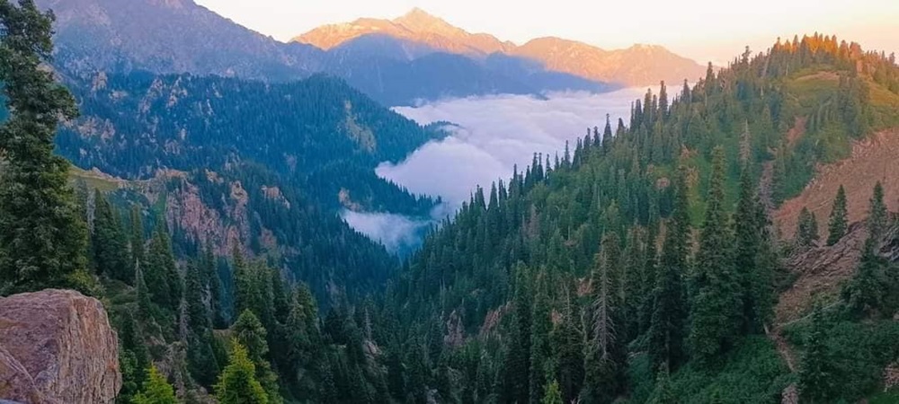
A scenic view of the towering trees on the hill slopes and the valley below in Kurram
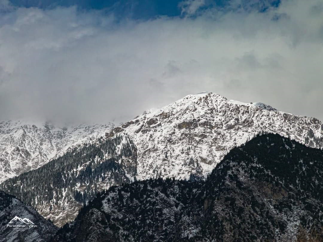
Spin Ghar
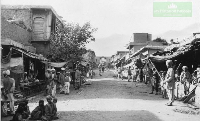
A bazaar in Parachinar, Kurram Agency, in 1918
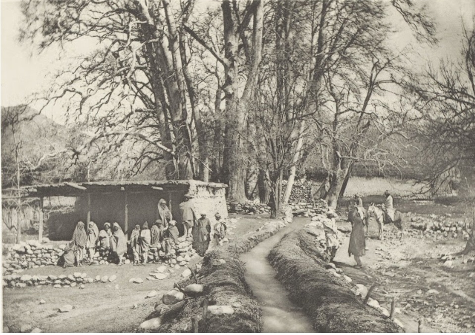
Chinar Trees at Shalozan (Photo by Frederick Saint John Gore)
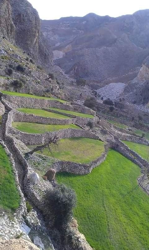
Terraced fields of Kurram
You may also like: