Written by: Anum Zaeem
Posted on: October 06, 2026 | 
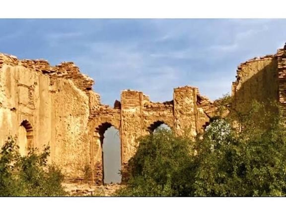
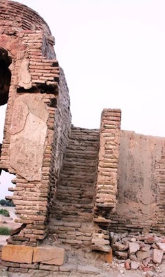
Surviving arched gateways of the old fort, framed by overgrown vegetation
Most people driving the road between Hyderabad and Badin have no idea they're passing one of the oldest cities in Sindh. There's no big signboard. No ticket window. Just a spread of low mounds near the town of Gulab Leghari, a few domes poking up over the scrub, and a lot of broken brick underfoot.
That's Agham Kot. Locals also call it Aghamano. For roughly a thousand years it was a working city with a river port, a fort, mosques, madrasas and markets. Today it's mostly dust, a handful of shrines, and an argument among historians about what exactly went wrong.
The story usually begins in the early 7th century with Agham Lohana, a governor from the Lohana community who ruled this stretch of lower Sindh. The town was named after him, and so was the fort.
Agham didn't get to enjoy it for long. When Chach, the Brahmin ruler based at Aror, pushed south after taking Multan and Sehwan, Agham held out against him. The accounts say the fighting dragged on for months and Agham died during it.
A scenic view of Baltit Fort Hunza
The Chachnama, the old chronicle of Sindh's conquest, remembers the pre-Islamic city as wealthy and sitting right on the river. That location was the whole point. Agham stood on the right bank of the Dhoro, a branch of the Indus that has long since dried up. Boats came in, goods went out, and the town grew rich on the traffic. Writers who've studied the site say the skyline back then would have included Buddhist stupas and Hindu temples, since those were the two big religious communities of the time.
The Arab armies reached Sindh in the early 8th century, and Agham became a trading town. The Tuhfat al-Karam, a later history of Sindh, describes it as an important commercial centre under Arab rule.
Local tradition says Muhammad bin Qasim stopped here briefly and ordered mosques to be built. I'd take that with a pinch of salt, the way you'd take most founding stories. Still, it tells you how the town likes to remember itself: as one of the places where Islam first put down roots in this part of Sindh.
After that, the city passed through pretty much every dynasty that ruled the region. The Soomras held it from around the 10th century to the late 14th. Then came the Sammas, Arghuns, Tarkhans, Mughals and finally the Kalhoras. Under the Mughals, it was listed as part of the pargana of Samawani, in the sarkar of Nasarpur, which is the kind of dry administrative detail that at least proves the town was still on the map.
The part of Agham Kot's history I find most interesting isn't the fort or the trade. It's the teaching.
By the Samma period, the town had become one of Sindh's big centres of learning, with a crowd of madrasas and students coming from all over. For Islamic education, only Thatta ranked higher.
The best-known name from that time is Makhdoom Muhammad Ismail Soomro, a Sufi scholar who ran a madrasa here that reportedly had around 500 students at its peak. He died in 1588 and is buried in a tiled tomb that still stands in the middle of the site. Local lore says Watayo Faqir, the wisecracking folk figure Sindhis tell jokes about, the way Central Asians tell them about Mullah Nasruddin, was one of his students and accepted Islam at his hands. True or not, it's a good story.
A scenic view of Baltit Fort Hunza
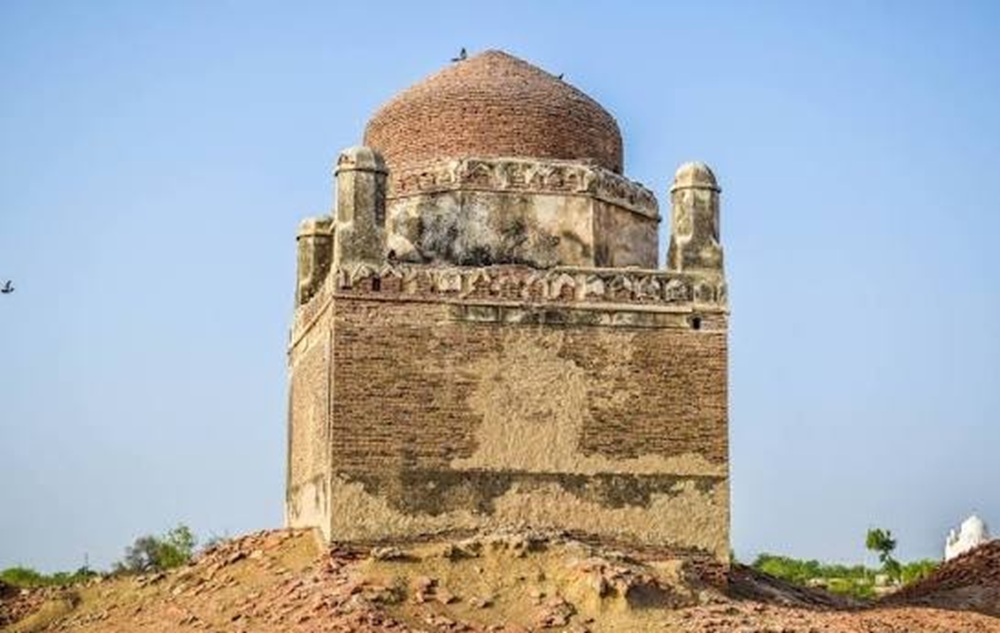
The Makhdoom's tomb is a small square building, about 8 by 8 metres, entered through a domed gateway. It was once covered in glazed tiles, and the inside was painted with flowers. Most of the tiles have fallen off now, and the paintings are badly damaged. His sons and a grandson are buried with him. His daughter, Bibi Ayesha, has her own tomb just to the north, and nearby lies Saeed Khan Madvani Laghari, a military officer who served the Kalhoras in the 18th century. The Makhdoom is regarded as the patron saint of the Patoli community, and his urs still draws people every year.
Then there's the tomb of Shah Abdul Majid, a Muslim saint who is revered as a patron by the Hindu Lohana community. His original tomb collapsed years ago, and it was Lohana devotees who rebuilt it. I like that detail a lot. A city founded by a Lohana governor, and centuries later Lohanas are still coming back to look after a Muslim saint's grave in the same ruins.
A more recent addition is the shrine of Bibi Maham, whom local tradition identifies as Khadijah, a daughter of Imam Musa al-Kazim who is said to have fled Abbasid persecution and settled here. Her grave was identified in 2002, and a shrine was built over it in 2009.
Supporters point to a Persian inscription on the headstone dated to 170 AH, which would make it the oldest grave in the area. It's a claim worth knowing about, though it hasn't had the kind of independent study the older monuments have.
The site covers about 200 acres of mounds, most of them three to five meters high. People have picked up pottery shards, terracotta toys, decorated tiles, and copper coins here, and the material has been dated to roughly the 8th to 13th centuries. The buildings standing on top of the mounds are later, mostly from the 17th and 18th centuries.
There are six mosques in various states of collapse. The Jami Mosque carries an inscription dating it to 1755, in the time of Mian Muradyab Kalhoro, and its stonework was carved by a Thatta engraver named Abu Talib Makarpayo. Right by the entrance is the Patanwari Masjid, the "mosque by the jetty". It was built next to the landing where cargo and passenger boats tied up, which is why it sits on a high foundation with thick walls. Only its arches are left. Standing there and looking at dry farmland where the river used to be is probably the fastest way to understand the whole site.
As for the fort, its walls were once about 20 feet thick, built from brick, ash, and lime. Most of it was wrecked in the 18th century, a storm in 1999 finished off a lot of what remained, and today only a short stretch of the outer wall is standing.
Nobody fully agrees.
One camp, including the Sindhi historian M.H. Panhwar, blames Madad Khan Pathan, an Afghan raider who sacked the town late in the 18th century (sources put it at 1781 or sometime in the 1790s). He burned the place. He also hit Badin and Nasarpur around the same time, but those towns were rebuilt. Agham wasn't.
The other camp, including the archaeologist Kaleemullah Lashari, points to the river. When the Indus shifted its course in the 1700s, the Dhoro dried up, and Agham lost the waterway that had kept it alive. Traders moved to Hyderabad, which was then the capital, or to Thatta. Later, when the British laid out their roads, Agham wasn't on anyone's list, and it was left to crumble.
A scenic view of Baltit Fort Hunza
My guess is that both sides are partly right. A town with a busy river can survive a raid and rebuild. A town whose river has already gone quiet probably doesn't bother.
Badly, honestly.
Agham Kot isn't on Sindh's list of protected heritage sites. It was put on a "tentative" list in 2015, which in practice means it gets no real protection. By 2019, around 130 of its 200 acres had been encroached on by houses and farms. When the 2011 floods washed out parts of the mounds and exposed old bones and artefacts, a lot of what came up was damaged or carried off, and people have been taking pottery and coins home or selling them for years. Local social workers asked the provincial archaeology department for help after the floods. One official came, but not for long.
The people who have done the most are the villagers nearby. Residents of the Leghari village next to the ruins set aside a room to store relics so thieves couldn't get them. That's the level of protection a 1,300-year-old city is currently getting.
Agham Kot is in Matli taluka, Badin district, about 60 km from Hyderabad and a short distance from Gulab Leghari. Go in the cooler months, between November and February, because there's no shade to speak of. There are no facilities, no guides, and no signage, so bring water and ask locals to point you to the Makhdoom's tomb and the Patanwari Masjid first.
Two small requests. Dress and behave the way you would at any shrine, because these are still active places of devotion. And leave the pottery where it is. Every shard that goes into someone's pocket is one less piece of evidence for whoever eventually gets around to studying this place properly.
It deserves that study. Agham Kot was a port, a garrison town, a centre of learning and a meeting point for Hindus and Muslims for most of a millennium. Right now, it's a set of mounds most drivers don't even notice.
You may also like: